
Drainage Strategy Blacko, Lancashire
20 Plot Housing Development
Blacko, Lancashire
Drainage Strategy, 20 Plot Housing Development
August 2025
- Completed
Project Overview
Classic Architecture proposed a new residential development at Blacko, Lancashire , consisting of a mix of detached and semi-detached dwellings with associated garages, landscaping, and a new access road. As part of the planning process, a robust surface water drainage strategy was required to demonstrate compliance with national and local planning policies and ensure resilience against long-term flood risk.
Challenges & Approaches
Challenge
The site lies within Flood Zone 1, indicating a low probability of river or sea flooding. However, the presence of impermeable clay soils and the site’s sloping topography (falling 19.79m across the plot) posed challenges for surface water management. The nearby open watercourses, which flow into Pendle Water, raised the need for controlled discharge, and the strategy had to accommodate climate change and urban creep allowances.
Approach
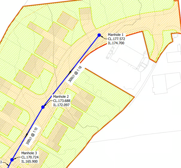
Courous Ltd. developed a detailed drainage strategy which included:
Review of local planning policy and SuDS discharge hierarchy
Soilscapes data analysis to assess infiltration potential
Calculation of greenfield runoff rate (5.77 l/s) using UKSuDS tools
Design of attenuation infrastructure to accommodate a 1 in 100-year storm + 50% climate change allowance
Incorporation of SuDS features such as permeable paving, rain gardens, and rainwater reuse options
Preliminary network modelling using InfoDrainage software
Two discharge outfall options identified subject to survey confirmation and regulatory approvals
Outcome
The strategy confirmed:
- Controlled surface water discharge into a nearby watercourse using a Hydro-Brake® flow control device
- 320m³ of on-site storage via an attenuation tank, with potential reductions through SuDS integration
- Design compliance with Defra’s SuDS standards and Lancashire’s Local Flood Risk Management Strategy
- No flooding within the site during a 1 in 100-year + climate change event, and appropriate provision for exceedance flows
- Drainage maintenance strategy in line with CIRIA C753 guidelines
Conclusion
The drainage strategy provided a sustainable and policy-compliant solution tailored to the site’s physical and environmental constraints. It ensured long-term resilience to climate change while minimising flood risk to the development and surrounding area. The report supported the planning application and set the foundation for a detailed design phase, subject to further survey and permitting.