What Is Flood Risk Assessment? A Comprehensive Guide
Discover everything about Flood Risk Assessment, including its definition, importance, and effective evaluation methods.
BLOG
10/24/20255 min read
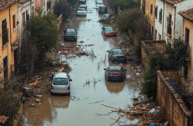

Flood risk assessment is a critical process that helps communities, businesses, and governments understand the potential dangers posed by flooding. By evaluating various factors, such as topography, weather patterns, land use, and historical flood data, this assessment enables informed decision-making to mitigate risks and protect lives and properties. This blog post will explore the fundamental concepts of Flood Risk Assessment, its importance, and how it can be effectively implemented to ensure resilience against flood hazards.
Crucial Role of the FRA: Why It Matters
The purpose of a Flood Risk Assessment (FRA) is to evaluate the likelihood and impact of flooding at a particular site and to identify measures that can reduce these risks, according to the National Planning Policy Framework (NPPF). This involves assessing the site's vulnerability to various flood sources like rivers, coasts, surface water, groundwater, reservoirs, and sewer blockages or bursts.
When preparing an FRA, it’s advised to consult with the local flood authorities, the Environment Agency, and relevant water and highway authorities. These groups can provide valuable data on past floods, modelling results, and site-specific assets. Different types of development projects have varying flood risks; for example, homes are more sensitive to flooding than quarry sites. The mitigation measures should match the vulnerability of the development and be proportionate to the risks. Given climate change uncertainties, it's also essential to add safety margins, such as freeboard allowances, to account for increased rainfall over the development’s lifetime.
When & Why Are The Flood Risk Assessments Required?
Flood Risk Assessments (FRAs) are essential for planning new developments and changing land use. They are needed for new buildings, especially in areas prone to flooding, and must be included in planning applications if a site is in a flood risk zone or near any water source. Existing buildings that are being significantly changed or extended may also need an FRA to assess potential flood risks.
When land is developed from greenbelt or brownfield sites, an FRA is often required to look at potential flood hazards, along with other studies. Large projects, such as roads or bridges near water, usually require an FRA as part of their environmental review. Local authorities or regulations may also require FRAs for specific projects to ensure flood risks are managed before construction begins.
FRAs help protect the environment by guiding development away from sensitive areas, preventing habitat loss and pollution. They are essential for ensuring compliance with laws and making policies, guaranteeing projects meet insurance needs, and planning cost-effectively to reduce flood damage. FRAs help in making smarter land use choices based on each site's unique traits, supporting sustainable growth and considering long-term risks like climate change.
What Is Included In An FRA?
Conducting a Flood Risk Assessment helps determine if a development project can be carried out on a particular construction site. It involves assessing if the area is in a flood zone and determining the land's condition. The assessment reviews existing flood data and provides recommendations to mitigate flood risk. It should be detailed and specific to the site and project in question. Usually, a Flood Risk Assessment includes the main points outlined below:
Risk & Impact Assessment
Site-Specific Risk: Analysis of the current and projected flood risks for the development site from all sources, including nearby rivers, the sea, surface water runoff, groundwater levels, and artificial sources such as reservoirs. It considers historical data, flood frequency, and geographic factors.
Development Impact: Evaluates how the proposed construction or developmental changes will influence flood risk both within the site boundaries and in the surrounding area, ensuring that the development does not exacerbate existing flood hazards.
Climate Change & Future Risk
Climate Change Allowances: Incorporates specific allowances for climate change projections, such as sea level rise, increased rainfall, and storm intensity, to ensure the development's resilience and safety throughout its entire lifespan.
Future Flood Levels: Estimates future flood levels by analysing climate models and projections, factoring in expected sea level rise and changing weather patterns, to determine the potential flood extent during the development’s operational life.
Mitigation & Management Measures
Flood Resilience & Resistance: Identifies and recommends structural and non-structural measures to enhance flood resistance and resilience, such as raised floor levels, flood barriers, water-resistant materials, and modular flood defences.
Sustainable Drainage Systems (SuDS): Consider the integration of SuDS, such as permeable paving, green roofs, rain gardens, and detention basins, to effectively manage surface water runoff, reduce flood risk, and promote sustainable water management.
Safety Demonstration: Provides evidence that the development will remain safe during flood events now and in the future, ensuring it does not increase flood risk for others, supported by modelling, flood risk assessments, and safety measures.
Site Details & Data
Site Location & Vulnerability: Offers detailed information about the development's geographic location, proximity to flood-prone areas, and the vulnerability classification based on flood risk data.
Flood Data: Includes detailed information on historical flood events, flood zones, flood extents, depths, and results from hydrological and hydraulic modelling used to predict flood behaviour.
Residual Risk: Identifies remaining flood risks after mitigation measures are implemented, acknowledging that some level of risk persists despite best efforts and planning.
Process of Flood Risk Assessment
The flood risk assessment process includes several essential steps that help us understand and manage flood risks effectively.
Site Analysis: A specialist in Flood Risk Assessment evaluates the site's location, proximity to water bodies, ground conditions, and topography.
Data Review: This involves consulting historical flooding data, the local authority's Strategic Flood Risk Assessment (SFRA), and any updated flood risk maps.
Hydraulic Modelling: Detailed models are used to simulate how heavy rainfall or tidal surges could affect the site, predicting flood levels, depth, velocity, and hazards.
Flood Source Assessment: The assessment considers flooding from all potential sources, including rivers, the sea, surface water (pluvial), groundwater, and artificial sources like canals or reservoirs.
Climate Change Impact: Projections for climate change are incorporated to understand how flood risk may increase over the development's lifetime.
Mitigation Measures: Recommendations are made for flood resilience and resistance measures, such as improved drainage systems and suitable finished floor levels, to make the development safe.
Impact on Surrounding Areas: The assessment also determines how the development might affect flood risk in the wider local area and proposes solutions if required.
Reporting and Planning Application: A formal report detailing the findings and mitigation strategies is produced and submitted as part of the planning application.
The Duration of a Flood Risk Assessment
The duration of an FRA can vary depending on several factors, including the complexity of the site, the scale of the proposed development, and the availability of necessary data. Generally, the process can take anywhere from 5-10 working days to a couple of months. Here’s a breakdown of what influences the timeline:
Data Availability and Quality: The time required to collect existing flood risk data, such as flood maps and historical flooding records, greatly influences the timeline. Delays in obtaining the data can prolong the assessment process.
Detailed Modelling: Creating comprehensive models of flood extent, depth, velocity, and potential impacts requires considerable time and resources, thereby impacting the overall duration.
Regulatory and Approval Processes: Regulatory steps, including consultations and approvals from agencies like the Environment Agency, can significantly extend the timeline.
Climate Change Projections: Incorporating climate change estimates, including future extreme scenarios over various periods, increases the complexity and length of assessments.
Uncertainty and Assumptions: Flood risk evaluations are influenced by natural variability and knowledge gaps, necessitating further investigation or assumptions that can delay progress.
Stakeholder Consultation: Interacting with stakeholders and collecting their input also takes time and adds to the overall duration.
Report Preparation: Preparing the final report, which details flood sources, likelihood, and impacts, and revising it if necessary, can be time-consuming.
Conclusion
A flood risk assessment is a crucial process that helps identify and evaluate the potential hazards posed by flooding to properties, communities, and infrastructure. Thoroughly analysing factors such as topography, historical flood data, climate patterns, and land use provides crucial insights that support effective planning, risk mitigation, and informed decision-making. Implementing comprehensive flood risk assessments enables stakeholders to develop targeted strategies to prevent or minimise flood damage, thereby enhancing public safety and promoting sustainable development. Ultimately, investing in detailed flood risk assessments is a vital step toward creating resilient environments capable of withstanding the challenges posed by flooding events.
Get In Touch
Courous, Suite 7a, The Globe Centre, Accrington, BB5 0RE
Find us on LinkedIn